
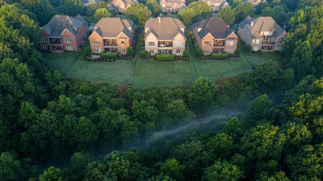
There’s a good chance someone has already told you that flood insurance is a coastal problem, something you worry about in Wilmington and forget about forty miles inland. That’s half right. Mint Hill sits southeast of Uptown Charlotte with no ocean anywhere near it, and most of the town is nowhere near a mapped floodplain. But the Mecklenburg County Flood Insurance Study, the federal document behind the map your lender’s underwriter prices from, studies ten streams in detail in and around Mint Hill, and the creeks it names here run right through town. Clear Creek alone is studied for 6.26 miles, from the Cabarrus county line down to Interstate 485.
So the question isn’t whether Mint Hill has flood risk. It’s whether the specific street you’re looking at does, and what that does to your monthly cost. The answer is street by street, and it comes down to four things: where the creeks run, why Mecklenburg County draws a wider map than FEMA requires, who really gets the 40 percent flood insurance discount you may have read about, and how to check one address before you write an offer. I’m Steve Jarrell. I live in Weddington and sell across South Charlotte, and the Mint Hill flood zone is the cheapest piece of due diligence in a purchase here. It is also the one that gets left to the lender.
14 min read | By Steve Jarrell, The Longleaf Group at eXp Realty | Updated October 2026
Free · 26-Page Insider Guide
Moving to Mint Hill? Know what the map says first.
Towns compared, NC vs SC taxes and schools side by side, and the 5 mistakes out-of-state buyers make.
What This Guide Covers
- Is there a Mint Hill flood zone, and where is it?
- The five creeks that carry Mint Hill’s mapped floodplain
- Why the county draws a bigger map than FEMA
- Who gets the Charlotte flood insurance discount, and who doesn’t
- What homeowners insurance leaves out
- How to check the Mint Hill flood zone for one address
- Frequently asked questions
Is there a Mint Hill flood zone, and where is it?
Yes, and it follows the creeks. Your odds of landing in one depend almost entirely on how close the back of the lot sits to a stream corridor. The mapped floodplain in Mint Hill runs along five creek systems, and the Mecklenburg County Flood Insurance Study puts numbers on each of them. If your street is up on the ridge between two of those creeks, you’re almost certainly out. If the back lawn falls away into trees, you need to look it up rather than guess.
The reason this matters to your budget and not just your peace of mind: if the house sits in what FEMA calls a Special Flood Hazard Area, your lender can require flood insurance as a condition of the loan. That’s a monthly number that never appeared in the listing.
The Short Answer
Mint Hill’s mapped floodplain follows five creek systems, and Mecklenburg County regulates to a wider map than FEMA requires. Figures below are from the Mecklenburg County Flood Insurance Study, Charlotte-Mecklenburg Storm Water Services and the NC Department of Insurance, read October 5, 2026.
The numbers, checked October 2026:
- 10 streams studied in detail in and around Mint Hill
- 6.26 miles: the studied length of Clear Creek, the longest reach in town
- 0.5 ft: the rise Mecklenburg uses to draw its floodway, against a 1.0 ft federal minimum
- 1 ft of freeboard above the future conditions flood, and 2 ft along the Catawba River
- 5,000 individual properties in the Charlotte-Mecklenburg regulated floodplain, per Storm Water Services
- 30 days: the standard wait before a new flood policy takes effect, with some exceptions
Flood risk is the kind of question that tends to get asked late, usually after the offer is in and the lender raises it. On a Mint Hill lot I’d rather know in the first ten minutes. The answer changes what a house costs to own, not what it costs to buy, and those are two different problems. The county’s map is free and it takes about two minutes to read.
Talk to a local broker
Want the flood map read on a specific Mint Hill address?
Send me the address and I’ll pull the county map and tell you what it shows. No pressure, just answers.
Schedule a 15-Minute Introductory Call →704-774-7170 · steve@jarrellhomes.com · thelongleafgroup.com
The five creeks that carry Mint Hill’s mapped floodplain
The Flood Insurance Study measures creeks, not towns. It covers all of Mecklenburg County and every jurisdiction in it, Mint Hill included, and for each stream it studied in detail it publishes a start point, an end point and a length. Ten of those studied streams run in and around Mint Hill, and five of them are creeks you will hear named around town. Clear Creek is the big one at 6.26 miles, running from the Mecklenburg and Cabarrus county line, the boundary at Mint Hill’s northern edge, down to a point about 1,655 feet upstream of Interstate 485, the outer loop highway that circles Charlotte.
Irvins Creek is almost as long at 6.19 miles, and it is the one to know if you are shopping the western side of town, since it runs down toward its confluence with McAlpine Creek rather than sitting wholly inside Mint Hill. Goose Creek and Duck Creek both begin at the Mecklenburg and Union county line on the south side of town, Stevens Creek feeds into Goose, and Duck Creek is the shortest of the five at 1.21 miles. For a sense of scale, the United States Geological Survey keeps a streamgage on Clear Creek near Mint Hill, station 0212466000, and the basin feeding that one point covers 12.6 square miles, which tells you how much land drains toward that single spot.
| Creek | Studied reach starts | And ends | Length |
|---|---|---|---|
| Clear Creek | Cabarrus County line | About 1,655 feet upstream of Interstate 485 | 6.26 miles |
| Irvins Creek | Confluence with McAlpine Creek | About 361 feet upstream of Lawyers Road | 6.19 miles |
| Goose Creek | Union County line | About 6,300 feet upstream of Lawyers Road | 1.99 miles |
| Stevens Creek | Confluence with Goose Creek | About 2,500 feet upstream of Thompson Road | 1.76 miles |
| Duck Creek | Union County line | About 6,435 feet upstream of the county line | 1.21 miles |
The other five are smaller streams the study measures on their own: Clear Creek Tributary, Sherman Branch, Stevens Creek Tributary, and Irvins Creek Tributaries 1 and 2. Notice what is missing from the table: street names. The study tells you where a creek runs and how far it was measured, and nothing about which lots sit inside the line. That is a map question rather than a report question, and it is why a town-level answer cannot help you and an address-level answer can. Two houses on the same cul-de-sac in Mint Hill can land on opposite sides of it. When a client sends me a listing backing to trees on the north end of town, I open the county map before I open the photos, because the creek is what decides whether that house carries a monthly number nobody has mentioned yet.
Why the county draws a bigger map than FEMA
Mecklenburg County regulates to more floodplain than the federal minimum, and that’s the single most useful thing an out-of-state buyer can know here. Three pieces of it show up on the map you’ll be reading.
Start with the future conditions floodplain. The county’s flood maps carry a second, larger floodplain based on the one percent annual flood modeled under potential future development rather than today’s. The study maps it as its own designation, a gray shaded Zone X-Future, separate from the blue Zone AE that carries the existing conditions floodplain and is what your flood insurance is actually rated on. The study is explicit that the future conditions floodplain and its elevations are used locally to regulate new development. That matters because the zone is about what the county will let you build, not about what your premium costs, and those are two different questions that look alike on a map.
Next comes the floodway itself. Federal rules let a community draw its floodway boundary using a 1.0 foot allowable rise in flood heights. Mecklenburg uses 0.5 feet. A tighter number means a wider protected channel and more restriction on what you can build in it.
Third, and this one does not exist in most of the country, the county draws a second line called the community encroachment line and uses it to regulate development alongside the floodway. The study confirms the line is in use but does not publish the surcharge behind it, so ask the county what it is for a specific parcel rather than trusting a number you read somewhere. One more rule shows up in the same section and it is the one that decides how high a new house has to sit: the minimum first floor has to be a foot above the one percent flood modeled on future land use, and two feet above it along the Catawba River. Development is restricted in both the standard floodway and the community encroachment area. If a listing mentions a lot with “room to add a shop out back,” these are the lines that decide whether that’s true.

None of this is Mint Hill going it alone. The town partners with Charlotte-Mecklenburg Storm Water Services to run its stormwater program, a joint city and county utility that also covers Charlotte, Cornelius, Davidson, Huntersville, Matthews and Pineville along with the unincorporated county. One mapping shop, one set of rules, eight jurisdictions, so the map you read for a Mint Hill address is the map Matthews and Pineville buyers are reading too.
Who gets the Charlotte flood insurance discount, and who doesn’t
Here’s where a lot of relocating buyers get a number stuck in their head that doesn’t apply to them. On April 1, 2025, the City of Charlotte was recognized as a FEMA Community Rating System Class 2 community. The Community Rating System is a voluntary program that rewards a community for floodplain management work beyond the federal minimum, and the reward is a discount on National Flood Insurance Program premiums.
The discount is large enough to matter. For policies within the city, it runs up to 40 percent off NFIP premiums for buildings in the FEMA regulated floodplain and up to 10 percent for policies outside it. Mecklenburg County says the change saves Charlotte residents an estimated $1 million or more a year, and puts the city in the top 1 percent of more than 1,500 communities in the program nationally, the top rated in North Carolina.
Read the county’s own wording closely before you count on it, though. The community being recognized is the City of Charlotte, and the release describes the smaller discount as applying to “all other NFIP policies within the city.” A Mint Hill address is not in the City of Charlotte. Mint Hill is its own municipality and its own flood insurance program community, carrying its own identification number, 370539, in the federal study.
What that means for a Mint Hill buyer is one phone call rather than an assumption. The Flood Insurance Study, revised in September 2015, carries no Community Rating System list at all, so it cannot tell you whether Mint Hill participates. Neither the county release nor the Storm Water Services page naming the Class 2 rating mentions the town. That is not the same as a no, and participation changes, so the right move is to confirm the current status with your insurance agent rather than assuming it either way. The same caution applies to a search summary or an AI answer, because a city-level discount and a town-level discount read identically in a one-line response.
If you’re still working out which jurisdiction a given address even sits in, that’s a separate and surprisingly common problem here, and I wrote about it in what a Mint Hill mailing address does and doesn’t tell you.
What homeowners insurance leaves out
Flood damage isn’t covered by a standard homeowners policy. You buy it separately. The North Carolina Department of Insurance states it plainly: homeowners insurance policies do not cover flood damage, and your lender may require flood insurance if the home is in a flood plain. The federal Consumer Financial Protection Bureau says the same of standard policies in its guidance on homeowners insurance, while noting it may be possible to add the coverage.
Two timing details decide whether this is an annoyance or a real problem for you. The first is that a new flood policy carries a 30 day waiting period before it takes effect, with some exceptions. The second is that the state reminds buyers not to assume a home outside a designated flood plain will never take flood damage.
The county has put real money behind the risk it maps. Its voluntary floodplain buyout program has purchased more than 490 homes since 1999, part of a $90.5 million total investment in removing buildings from the floodplain, funded 43 percent federal, 48 percent local, 2 percent state and 7 percent other. Storm Water Services counts 5,000 individual properties in Charlotte-Mecklenburg’s regulated floodplains, and says every one of them is carried in the risk reduction plan the county updates each year. The map moves over time, and it moves because of water that has already turned up somewhere.
For what the rest of the monthly picture looks like here, including how insurance sits alongside taxes and utilities, see our breakdown of the cost of living in Mint Hill.
The part that catches people is that 30 day wait. You can’t decide at the closing table that you’d like flood coverage and have it in force that afternoon, and if your lender is the one who flags the zone, you’re already behind the calendar. I treat the flood map as a day one due diligence item on any Mint Hill house backing to trees, right alongside the survey and the HOA documents. It costs nothing and it can change which house is worth touring.
Talk to a local broker
Shortlisting streets in Mint Hill?
We can walk the map together before you spend a Saturday touring.
Book a 15-minute call →How to check the Mint Hill flood zone for one address
You can settle this yourself in a few minutes, and you should do it before the inspection period rather than during it. The question has different answers depending on which map you open, so use more than one.
The local map is the one to open first. Charlotte-Mecklenburg Storm Water Services runs an interactive 3D floodzone map built for exactly this question, and you can reach it from the Storm Water Services site, which also carries the flood notification system that posts live creek levels.
Then the federal panel, because that is the one an underwriter prices from. The FEMA Map Service Center gives you the official Flood Insurance Rate Map covering an address. North Carolina keeps its own copy, the Flood Risk Information System, and it holds the full Flood Insurance Study text, which is where the creek by creek numbers here come from.
Three things to do with what you find. Ask your insurance agent for a real quote on the address rather than a state average, because the premium is set on the specific building, its elevation and its flood zone, and then adjusted by the community’s rating. Find out which community rating applies. Then, if the property sits anywhere near a line, ask the seller whether a flood policy is already in force.
One caution about the private flood risk scores you’ll see on listing portals. They are private models, not the regulatory map, and they are not what a lender prices from. Read them if you like, but settle the question on the county and FEMA maps.
If the back of the lot slopes toward trees, look it up before you tour it, not after you write. If you want help reading any of it, that’s what we do: our Mint Hill community page has the rest of the town picture, and the South Charlotte market data hub carries current prices across all thirteen areas we cover.
Frequently asked questions
Is Mint Hill NC in a flood zone?
Part of it is, and your street decides the answer. The Mecklenburg County Flood Insurance Study studies five creeks in detail around the town: Clear Creek, Irvins Creek, Goose Creek, Stevens Creek and Duck Creek. Clear Creek is the longest at 6.26 miles, running from the Cabarrus county line to Interstate 485. Most of the town sits outside the mapped floodplain, so the only answer that helps you is an address level answer, checked on the county and FEMA maps as of October 2026.
How do I find the flood zone for a specific Mint Hill address?
Use three sources before you write. Charlotte-Mecklenburg Storm Water Services runs an interactive 3D floodzone map and it is the local mapping shop’s own. The FEMA Map Service Center gives you the official Flood Insurance Rate Map panel an underwriter will price your loan from. The North Carolina Flood Risk Information System holds the full Flood Insurance Study. All three were live and free to use on October 5, 2026.
Is flood insurance required for a home in Mint Hill NC?
It depends on your address and your loan. The North Carolina Department of Insurance states that a lender may require flood insurance when a home is in a flood plain, so on a Special Flood Hazard Area address the practical answer is usually yes. A standard flood policy also carries a 30 day waiting period before it takes effect, with some exceptions, so this is a day one question rather than a closing week question.
Does Mecklenburg County have stricter floodplain rules than FEMA?
Yes, and in three ways that can affect what you are allowed to build. The county’s maps carry a future conditions floodplain based on the one percent annual flood under potential future development, mapped as its own gray shaded Zone X-Future and used locally to regulate new development. The county draws its floodway using a 0.5 foot rise where the federal minimum allows 1.0 foot. And it uses a second line, the community encroachment line, to regulate development alongside the floodway.
Can a Mint Hill home outside the mapped flood zone still flood?
Yes. The North Carolina Department of Insurance warns buyers not to assume a home outside a designated flood plain will never take flood damage, which is also why Mecklenburg maps a future conditions floodplain for development that has not happened yet. A Zone X-Future on a Mecklenburg map is not the same low risk signal a plain shaded Zone X is elsewhere in the country.
Does the Charlotte flood insurance discount apply to a Mint Hill address?
Do not assume that it does. On April 1, 2025 the City of Charlotte was recognized as a FEMA Community Rating System Class 2 community, worth up to 40 percent off National Flood Insurance Program premiums in the regulated floodplain and up to 10 percent outside it, and Mecklenburg County described the smaller discount as applying to policies within the city. Mint Hill is a separate municipality and a separate flood insurance program community, number 370539. Ask your insurance agent which community rating applies to the exact address before you put a discount in a budget.
About the Author
I’m a licensed North Carolina and South Carolina broker and the team lead of The Longleaf Group at eXp Realty, which I co-lead with my wife Amanda. Before real estate, I joined VisualTour as President, led its rebrand to Paradym, and led the company to its acquisition by Constellation Software in 2020. I hold an MBA from the University of Tennessee with concentrations in Marketing and Innovation. The Longleaf Group is an eXp ICON Team and a RealTrends Verified Top Team by Volume for 2026, with 140+ five-star reviews.
I live in Weddington, on the other side of Union County from Mint Hill, and I write up the things buyers relocating here keep running into late. Flood maps are free and public, and the questions they settle are the ones that are cheapest to answer early.